
Greg Asner
Department of Global Ecology, Carnegie Institution for Science.

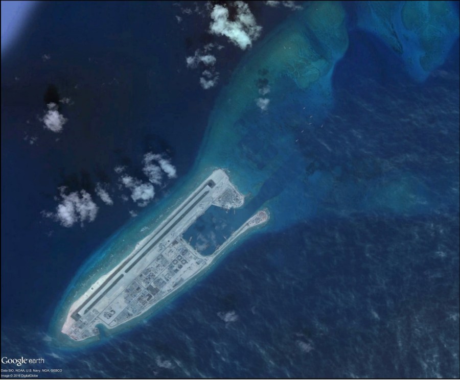
A remote region of the South China Sea harbors an archipelago of atolls, reefs and a few islands called the ‘Spratly Islands’. Zoomed out, the Spratlys seem to float in suspension, like a dim stellar constellation of underwhelming dots, offering little to the casual Google Earth surfer. Zooming in, one gets lost in the more than 100 coral reef features that comprise the Spratly Islands, many of them separated by huge expanses of deep blue ocean. If not for recent news, such as a New York Times feature, you might miss the fact that about 15 of the Spratly atolls have been radically altered for use as military bases and other types of government outposts. What governments? Malaysia, Philippines, and Vietnam each claim a portion of the Spratly archipelago, and China claims all of it. And therein lies the challenge for biodiversity conservation.
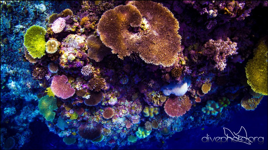
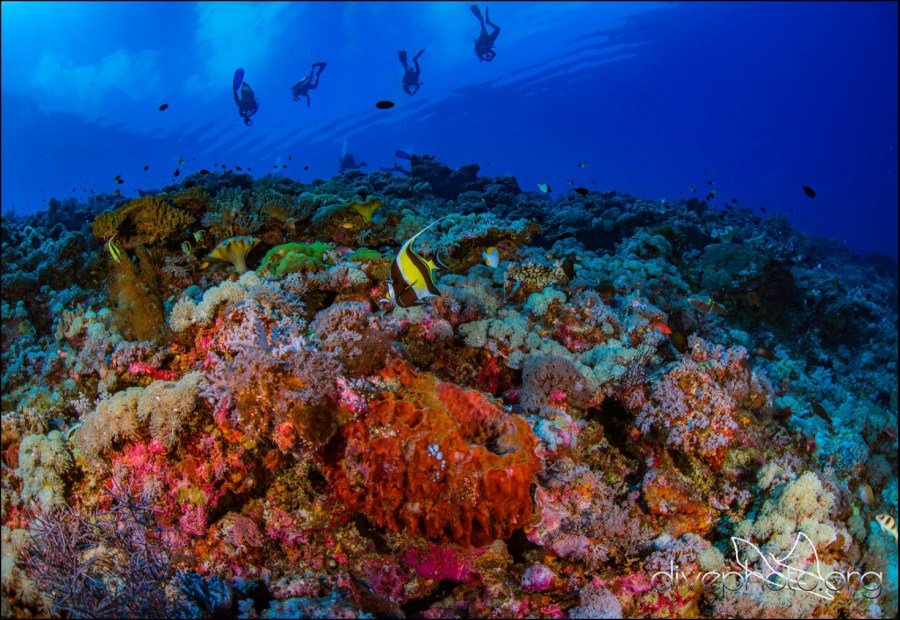
As a whole, the Spratlys are said to contain in the order of 600 coral and 6000 fish species. Yet we really don’t know all that’s out there, and we have a relatively poor understanding of how the Spratlys – a system of ecosystems – is put together evolutionarily or ecologically. So it is ironic that a region we hardly know is rapidly being converted by governments to military bases and outposts, in the name of sea power, trade routes, fossil oil exploration, and fisheries control.
As ecologists and conservation scientists, we know well the ever-growing number of challenges, and urgency, to understand the ecological processes that underpin, sustain and promote biodiversity and human well-being. A remote region like the South China Sea, replete with numerous military, cold war-like interactions, makes it hard for us to explore its biodiversity, and to understand how it is changing. Such cases make remote sensing all the more valuable.
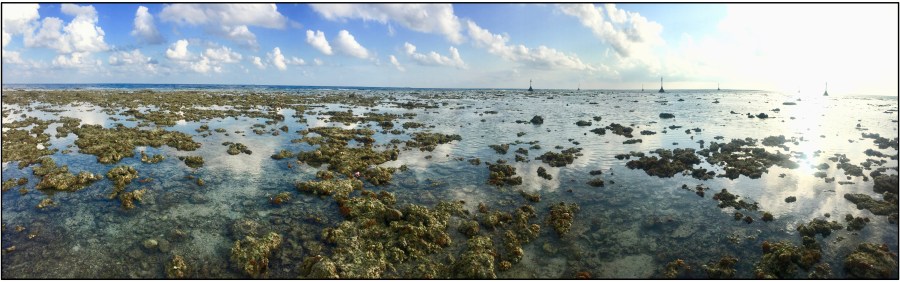
The Spratly Islands are found in a relatively cloudy part of the world, to the northwest of Borneo spanning about 7 to 11 degrees north latitude. It’s a hard place to visit, save from a few opportunities based on underwater ecotourism. I learned of one of these accessible atolls in the Spratlys, called Pulau Layang Layang, and thought it might give us a glimpse into the spatial ecology of coral reefs in the context of the broader region. Getting out to Pulau Layang Layang was a process that yielded a much improved understanding of reef composition and hydro-geomorphology. Dr. Robin Martin of the Carnegie Institution for Science and I spent two long field trips there in 2016, where we compiled thousands of underwater photographs, video surveys and biodiversity information. In short, we got to measure and to know Pulau Layang Layang well enough to interpret its composition in satellite imagery.
We took our field-based knowledge and partnered with Planet.com, formerly known as Planet Labs, to see if we could use their daily 3 to 5 meter resolution Earth monitoring capability to map coral reef, sea grass, and other atoll features. Planet controls the largest constellation of small satellites orbiting Earth, and their “Dove” constellation is comprised of numerous color and color-infrared cameras. Working with Planet’s Dr. Joe Mascaro, a former postdoc in my lab at Carnegie, we compiled, analyzed and classified the Dove data to find that we could accurately map shallow coral reef, and even some aspects of much deeper reef. While the finding was not all that new in the generic coral reef remote sensing “sense”, we were excited that Dove imagers could be used on a near daily basis to track changes in atolls such as the Spratlys. In our initial study published in Remote Sensing in Ecology and Conservation, we used the Planet Dove data to classify numerous atolls and islands in the Spratlys, and to show that we can measure and compare coral reef cover among occupied and unoccupied portions of the archipelago.
Moving forward, we are planning to use Planet Dove data, not only to monitor coral reef cover in the South China Sea, but to extend our effort to other reef ecosystems, and to direct my aircraft remote sensing platform called the Carnegie Airborne Observatory (CAO) to provide more detailed biodiversity assessments using our high-fidelity imaging spectrometers (a.k.a. hyperspectral sensors). In this context, I see Planet Dove and CAO packing a one-two punch for coral reef science and conservation in the coming years.

Classification of an atoll using Planet Dove satellite imagery. From top to bottom: Planet Dove image; location of underwater survey points and transects; atoll classification. Adapted from Asner et al. (2017) Remote Sensing in Ecology and Conservation
