
By Francisco Javier Ancin-Murguzur
This blog accompanies the paper: Drones as a tool to monitor human impacts and vegetation changes in parks and protected areas. Read the full paper here
Monitoring trails is an essential part of the conservation work in protected areas to assess how visitors affect the trails and their surroundings. When we think of “leave no trace”, we think of people picking up their garbage and sticking to the trails: what we often forget is that even when we are respectful with nature, we do affect the trails and their surroundings just by walking on them.
When we walk on trails, we are actually making the trails deeper and wider. How many times do we walk on the edges of the path to talk side by side to our friends? The answer is very often. We trample the vegetation, and even create new trails that go to interesting landmarks.
A sustainable trail network needs to allow free movement of plants and animals, and to preserve the character of wild, scenic and cultural landscapes. When visitor number increases, the pressure on the trails are higher, and this could turn a narrow, Instagram-friendly trail into a wide highway.
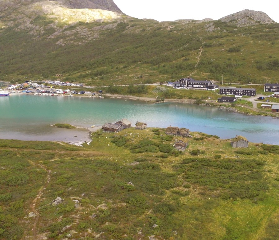
Figure 1 Our study site. Historically important cabins surrounded by stunning nature in Norway
Visitor impacts are often measured by walking these trails measuring whether trails are too deep and wide and if the erosion and degradation of the trail is too high. The manual work that we need to do in order to get a good grasp of what is happening in our trails requires lots of skilled people to work under all weather conditions, risking to lose information when weather turns for the worse or the data sheets fly away (it does sometimes happen!).
Nowadays, we have access to fun tools that can help us do the work from a computer: drones! Yes, the small toys that everyone loves to fly and capture stunning images and footage. During one of our field campaigns around a historical site, we had a drone with us by chance (we have to admit, we brought it because it is a fancy toy to get nice photos). After several hours measuring the trails and having to take several breaks due to mosquitos (and plenty of coffee breaks), we thought “why don´t we fly the drone over our study area and create a very precise mosaic of photos?”
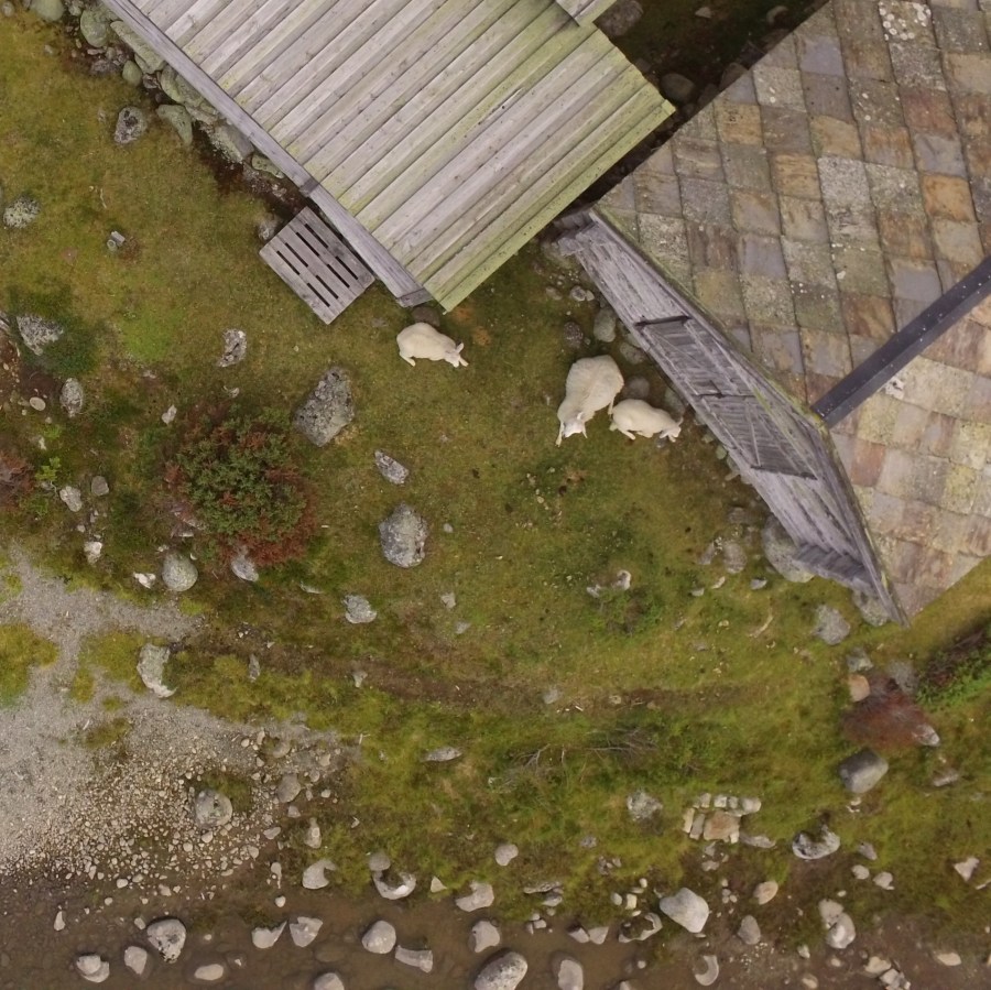
Figure 2 Sheep did not mind our buzzing friend flying over them
With that thought in mind, we decided to take hundreds of overlapping photos of the terrain with our drone, flying at a very low height, and avoiding crashes with trees. These photos had a very high resolution, and we could see individual leaves of grasses on the ground! We felt we were on to something good, so we continued this work in the office afterwards. Using open source software and a method called photogrammetry, we created a big mosaic of the terrain (technically called an orthophoto), and a model of how the surface looks like (a digital surface model, or DSM). The orthophoto allows us to measure the trail in our computer, using simple tools, and the DSM lets us see the trail contour. Combining these two, we can now measure how deep the trail is becoming under the influence of visitors, also how wide it is.
But the results did not stop there: we could also classify the vegetation on the orthophoto and see where the bare soil, grasses and shrubs were in the landscape, which makes it easier to assess what areas will be easier to walk on. We all prefer to walk on grass than between bushes, don’t we?

Figure 3 We can quickly see how the vegetation is distributed in the landscape, and see how it changes with time
All this process can be done in the computer, after a short field expedition, and the orthophoto and DSM can be stored to be analyzed at any given time. If we want to compare how the landscape looked like after a few years, we can just load the images and directly compare it to the present state of the landscape: do we have more grasses? Did the trail become wider? How long did it take before a trail was restored after closing it?
We think that this advance in technology will make our work easier and more accessible. Using open source tools that are free of charge is an added advantage to this method that can be used by anyone with a very tight budget.
So, what are we waiting for? Let’s get our drones out and map our backyards! Remember to follow the rules in your areas, and ask for permission if necessary.
