
By Hannah White
This blog accompanies the paper: Quantifying large‐scale ecosystem stability with remote sensing data. Read the full paper here
We want ecosystems to function. On top of that, we want them to maintain their functioning at a predictable, consistent level. In the face of global change, however, this may be problematic. We need tools to be able to measure how stable ecosystems are, particularly as the frequency and intensity of extreme climatic events is set to increase, so that systems are able to work in a predictable way that is beneficial to both people and nature.
Much of the fundamental ecological theory investigating ecosystem functioning and stability has been established in small scale field experiments; far smaller than the scale at which land is managed and communities interact. Little has been done, however, to scale up stability research to the landscape scale, potentially down to the challenges associated with temporal monitoring of ecosystem functioning over large extents, particularly when the exact timing and magnitude of environmental disturbances remain unknown. Satellite data provides the ideal tool to measure temporal change in ecosystem functioning, such as plant productivity, allowing large scale investigations of stability in natural systems.
We developed a method using the enhanced vegetation index (EVI) as a measure of plant productivity taken from the MODIS platform to establish a series of stability metrics analogous to those which have previously been established at the small, experimental scale. These are: temporal variability; resistance; recovery time; and recovery rate (i.e. engineering resilience). Although we used EVI, the approach could be applied to any number of remotely sensed ecosystem functioning data. Our method differs from previous attempts at monitoring stability and resilience using remotely sensed data, which have all focused on stability in respect to a particular environmental disturbance, such as a specific climate anomaly, or vegetation recovery following fire. We use the ecosystem functioning data itself to identify disturbances using an EVI anomaly, i.e. how much does the EVI deviate from what we would expect in a particular place within a particular month established from a 20-year baseline, irrespective of variation within the physical environment.
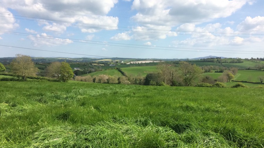
We applied our metrics to a case study of the island of Ireland where we were able to identify large disturbances to plant productivity at the scale of 1 km x 1 km grid cells through large deviations in the EVI anomaly, and long periods of recovery following these disturbances. These match periods of time known to have suffered extreme climatic events, such as the heavy snow and low temperatures experienced during the winter of 2010, but also matched periods where no extreme events occurred according to Met Eireann, but where there was known prolonged periods of reduced productivity including the fodder crisis of 2012-2013. During this period, Ireland, which is predominantly pasture farmland, was unable to produce enough fodder to feed it’s nearly 7 million cattle and feed had to be bought in from England and France. It’s not just that one or two fields weren’t being productive, the drop in ecosystem functioning happened over a huge spatial extent, and affected thousands of small fields across the country. There were significant reductions in milk production and many farmers lost large portions of their livestock, some being forced to slaughter their cows prematurely. The 2012-2013 fodder crisis is estimated to have cost the Irish €500 million. This huge reduction in grassland productivity, however, was not the result of a single extreme event, but the combination of a relatively poor growing season in 2012, followed by a long winter period. Our novel method picked up this disturbance event alongside other smaller-scale fodder crises, including early 2018, which would not have been identified using climatic data alone.

Our new approach using remotely sensed data to assess the stability of ecosystem functioning allows the investigation of classic ecological theory across landscapes, as well as having clear important value in predicting ecosystem service provision under future global change scenarios at a scale appropriate to land management. Now that there is a body of research studying stability at the field level, it’s time to scale up and study stability across landscapes. Remote sensing allows that, and our paper demonstrates how.
